Storm Formation Signals Elevated Flood Threat
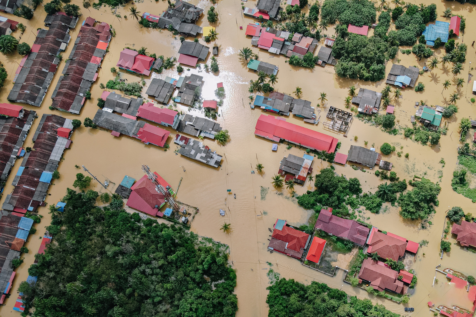
Houston authorities issued updated flood advisories after meteorologists identified a developing storm system over the Gulf of Mexico. The National Weather Service confirmed that the system shows signs of slow movement, increasing the probability of prolonged rainfall across Harris County. Forecast models indicate that several neighborhoods, particularly those in low elevation zones, may experience rapid water accumulation in the event of sustained downpours.
City officials highlighted that soil saturation levels remain high from recent rainfall events, reducing the ground’s absorption capacity. As a result, even moderate precipitation could lead to street flooding and drainage backups.
Emergency Teams Activate Response Protocols

Houston’s Office of Emergency Management initiated pre storm protocols to prepare for potential flooding. Response teams began clearing major drainage lines, inspecting pump stations, and coordinating with public works departments across the region.
Shelters and community centers have been placed on standby in case evacuation support becomes necessary. Local authorities urged residents to monitor weather alerts and plan for safe travel routes. Emergency communication networks will be updated periodically to provide guidance regarding high water areas and road closures.
Vulnerable Neighborhoods Under Heightened Monitoring
Several districts including Greenspoint, Meyerland, East Houston, and parts of Katy remain under close observation. Historical data indicates that these regions experience recurrent flooding during slow moving storm systems due to limited drainage gradient and high population density.
Residents living near bayous and creeks were advised to secure essential belongings, review evacuation plans, and avoid driving through waterlogged streets. Officials reiterated that even shallow moving water poses significant risk to pedestrians and vehicles.
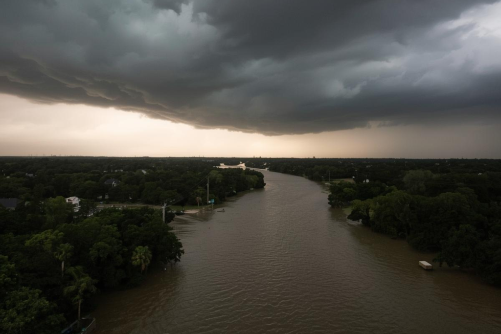
Meteorological Analysis of the Developing Storm
Weather specialists describe the storm as a moisture heavy system drawing warm air from the Gulf, enhancing rainfall potential. Its slow progression is a primary concern because stationary or slow moving systems deliver extended rainfall over narrow geographic zones.
Forecast data suggests that rainfall intensity may fluctuate based on temperature shifts and coastal wind patterns. Meteorologists emphasized that conditions could change rapidly depending on atmospheric pressure variations along the Gulf’s western edge.
Infrastructure Considerations and Flood Mitigation Efforts
Houston’s civil engineers continue to evaluate drainage network performance as recurring storms highlight the limitations of existing systems. Several mitigation projects, including channel expansions and basin retrofits, are underway but not yet completed. These expansions aim to improve water flow efficiency across flood prone districts.
City planners noted that legacy infrastructure remains vulnerable during peak rainfall periods. Investment in long term resilience projects is ongoing, with emphasis on stormwater retention systems, pump modernization, and improved land use planning.
Community Response and Preparedness Measures
Neighborhood associations and volunteer groups across Houston began distributing preparedness checklists to residents, particularly in districts with recurrent flood histories. The materials stress essential measures such as stocking emergency supplies, securing outdoor items, and verifying that sump pumps and backup power sources are operational.
Local stores reported increased demand for batteries, bottled water, and basic emergency equipment. Insurance providers have also experienced a rise in inquiries from homeowners seeking updates on flood coverage requirements.
Transport and Business Sector Adjustments
Houston’s transportation network may experience disruptions as heavy rainfall often affects major highways including I 45, I 10, and Beltway 8. Traffic authorities prepared temporary detour plans to redirect vehicles away from waterlogged sections. Metro services are coordinating potential schedule changes depending on rainfall severity.
Business owners in flood prone areas reviewed continuity plans to minimize operational impact. Warehousing facilities and logistics companies implemented additional safeguards to protect inventory from potential water damage.